
The Wildlife of Omand's Creek (1992) - The Study
| By Doug Collicutt | (Click links for more images.) |
Introduction and Methods
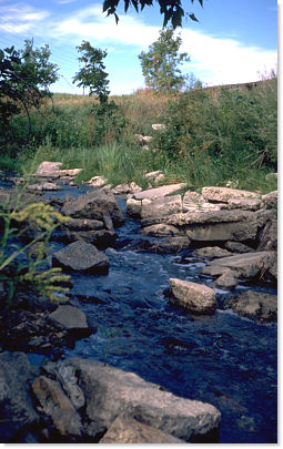 Riffles at the north end of Area 1 composed of concrete rubble from past developments.
The value or significance of any resource cannot be fully appreciated without some degree of objective appraisal. Recent proposed developments along Winnipeg's Omand's Creek, and the controversies they have stirred, have brought into question the value of the wildlife resources this area has to offer. Local residents are often aware and appreciative of the wildlife that flourishes in and along their nearby waterways, but documentation of these resources seldom exists. If wildlife is to receive the consideration it deserves with regard to future development or land use along this or other urban waterways, it needs to be represented formally and promoted as a resource of genuine value. The intent of this project was to provide such a formal record to help ensure that wildlife will, in future, receive due consideration. This report documents a wildlife inventory conducted along sections of Omand's Creek, in Winnipeg's West End.
The immediate goal of this work was to identify and record the diversity of wildlife found in and along a selected section of this waterway. Surveys were conducted from April to October, 1992. In addition to identifying the species of plants and animals present in the study area, attempts were made to estimate the populations of certain species. Data were also collected in such a way as to demonstrate the recreational and educational potential of these areas; to gauge the opportunities available for observing, enjoying and learning from urban wildlife.
This study builds upon work done by the author in 1986 to inventory the wildlife of Omand's Creek. The same section of Omand's Creek was re-inventoried in 1992. Comparisons of the results of the 1986 inventory with that of 1992 are not included in this report.
The Study Site
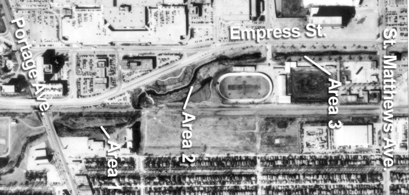
The Omand's Creek study area is shown in Figure 1. It encompasses a 1 km stretch of the creek and encloses 8.5 ha. Three distinct sections are apparent within the study site.
Area 1 is bounded by Portage Ave. to the south and the railroad bridge to the north. It is 250 m long with an area of 1.7 ha. Much of Area 1 has been relatively undisturbed for many years. The banks of the creek are quite steep and the terrain is often uneven, the result of numerous bank failures. The area may best be described as a small valley or ravine. The creek is narrow (1-2 m across) and shallow (0.5- 1 m deep) at the south and north ends of this section. A beaver dam 150 m north of Portage Ave. has created a large pool (4-5 m across and 2 m deep) in the middle of this section. There are rocky shallows immediately east of the railroad bridge.
Area 1 looking south from the north end.
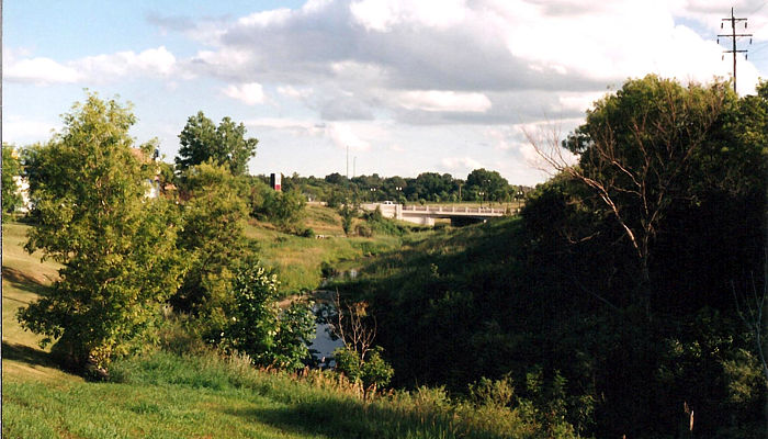
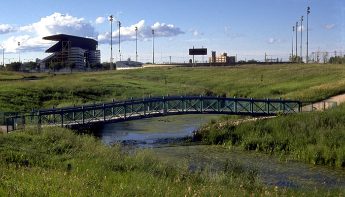
Area 2 begins at the railroad bridge and extends to below Rapelje Ave., essentially encompassing Bluestem Nature Park. This section is 300 m long and encompasses 4.2 ha. The topography is much gentler than Area 1, with lower slopes to the creek bank, and adjacent fields that are relatively flat. The creek is fairly wide (2-6 m across) throughout Area 2 and as much as 1.5 m deep. There are beaver dams at both the north and south ends of this section.
Area 2 looking north.
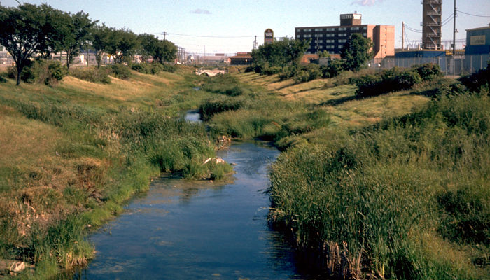
Area 3 extends north from Rapelje Ave. to St. Matthews Ave. It stretches 500 m and encompasses 2.7 ha. This section of the creek has been channelized and runs parallel to Empress Ave. This area was formerly maintained as ornamental parkland with planted trees and shrubs and mown lawn. Maintenance, other than weed control, ceased in the early 1980's. The creek forms a large pool, greater than 5 m across and 1.5 m deep, at the south end and narrows northward to shallow mud flats only 1-2 m across. The creek banks have an even slope throughout this area.
Area 3 from Maroon's Rd. looking north.
[Note: Since 1992, the land adjacent to Area 3 has undergone major changes. Gone are the Fire Department Training Centre, Alexander Park and the Velodrome. In their place is major shopping centre.]
Wildlife Inventory Techniques
Careful and consistent observation was the major technique employed in this study. No specialized ecological analyses were involved. A variety of surveys were conducted regularly from April until October 1992 to record the species present in study areas, and, when possible, to estimate the size of the populations of certain species.
Plant Survey
On a regular basis the study areas were surveyed for new plant species. Plants were recorded as present if they were readily identifiable in the field. Specimens were collected and preserved only if they could not be immediately identified. Notes were made on the relative occurrence of each species within each section of the study area.
General Survey
This survey, intended primarily to record and enumerate birds, was conducted once or twice weekly from April 13 to October 25 along the creek. A general survey involved walking the length of the study area and recording all instances where identifiable individuals or groups of birds were seen or heard. Birds in flight were included only if they were flying directly over the site and were less than 50 m above the ground. All observations of mammals and reptiles were recorded as well. Only significant observations of amphibians, fish and invertebrates were recorded. From the starting point at one end of the study site the area was traversed along one side until the opposite end of the study area was reached. The survey then continued back to the original starting point along the opposite side of the creek. Each survey, therefore, covered the study area twice.
General surveys were usually conducted within 2-3 hours after sunrise and were normally 1-1.5 hours in duration. A few were conducted around sunset or mid-day.
Amphibian Breeding Surveys
In spring and early summer, during their respective breeding seasons, it was possible to estimate the minimum numbers of frogs and toads within the areas from counts of calling males. On selected evenings counts were made of the numbers of calling males in each section of the study area. Assuming a 1:1 sex ratio, the minimum size of each species population was estimated by doubling the maximum number of calling males encountered in any one survey.
Aquatic Sampling
A regular program of seining and dip-netting for aquatic organisms was conducted throughout the study period. Only significant findings or observations, such as the occurrence of a new species or major changes in the populations of certain species, were recorded. Sampling was conducted in all sections of the study areas and in all the various aquatic habitats available. When necessary, specimens were collected for identification.
Incidental Records
Significant observations of any species were always recorded regardless of the specific survey underway at the time. The mention of sightings as incidental records, however, only applies to sightings of bird species which were not made during general surveys.
Species Identification
Species were identified using a variety of field guides and taxonomic keys. For each group of organisms one source was chosen to provide the common and scientific names given in the results, and the taxonomic order in which they are presented. All the literature used in this work is listed under the Acknowledgments at the end of this report.
Carry on for The Flora of Omand's Creek![]()
| You can help NatureNorth produce more great articles with a secure donation through PayPal. Our Google Adsense ads pay our server costs, but that's about it. To learn more follow this link: Support NatureNorth. Thank-you! | |
Return to: Winter Issue | NatureNorth Front page